impact structures

Webster Springs Intermontane Crater >>
.jpg)
Webster Springs Intermontane Crater >>
<<<<<Huntington Crater
Clarksburg Crater >>


Tim McClard's Honeycomb Rock Trail post in detail. First the honeycomb. This is a shock made harmonic, called boxwork. This is discussed below in greater detail. Honeycomb rock trail West Virginia.

This bolder picture by Tim McClard is a shock made cinder mega clast on the Honeycomb Rock Trail, West Virginia. The voids (vesicles) are evaporation. Impact makes heat at an atomic level ripping matter apart through a shock compression rarefaction. The surviving matrix is metamorphic with nano minerals you can see by the colors. It is a particle structure from the impact pulverization as are the minerals. The shock particle storm will form a "common particle" with distance as this matrix is not it was close to impact. You can even see quarts spheres attached. These are called impact spheres. You can see my encyclopedia of impact cinders at: https://www.hillbillyu.com/cinders-shock-impact-craters
Cinders this size I associate with the large earth impact simi-accretion events. This one would be the Silurian Impact Extinction Event which is centered at the New Madrid fault and the crater wall is the Appalachian Mountains. That being said the two big impacts Huntington and the North WV crater(s) could also make this splatter and voids.

You would not think soil would be constructed all the way back to the Silurian, but look, it corresponds to the impact.

Impact Spheres, large. Old from big earth impact. Huntington Crater, WV, USA
Tiffany Cuevas
Feb. 28, 2023
Check this out! Mountains of West Virginia. We were riding the Hatfield McCoy trails, stopped for a break and I always end up wandering around and checking out the rocks and woods... Then I find this! Concretion? But I want to know how.. please explain like you're explaining to a 5 year old.


Impact boxwork random - this iron splatter is from a large meteor liquified in impact. Random splatter boxwork does not have the impact wave organization to make geometric figures like is found at the waffle rock state park and star to the NE is Waffle Rock State Park. Star above shows the location of Audra State Park. Oct. 23, 2023.
Andrea Stalnaker
I found this rock while hiking along the river at Audra State Park, West Virginia-USA. I didnt take it home that day. I went back for it later though and someone had moved it and busted it into pieces. I only have a few pieces of it now. I looks to have iron in it. Any ideas what type of rock this is? I loved the veining. Thank you! I am new to this group.
Black and red iron oxide with silica Fe3O4SiO2. Let me offer you a few thoughts from my experience about the diatribes from those unable to think. First, they want to exclude debate as they are insecure about their science. It is called cognitive dissonance. Second, they offer no physics, a scientific mechanism but want to point you to somebody else's explanation as they are not able to truly explain. Next when I worked in the world's largest research laboratory nobody's science would be funded without a physics mechanism explanation. Impact explains your specimen completely with only one mechanism. Even though the frustrated non- scientific, exclusionary poster did not present a true case let me. As you can read on Wiki ironstone boxwork for some unexplained reason has crossing veins that become weathered reducing the in between components. Your specimen really does not look like that as it has the iron in a sheet flow but that is stacking two mechanisms one of which is unexplained. In any theory the stacking of physical mechanisms is much less likely than a single mechanism. It is why the lottery uses stacked numbers to work against your probability of winning. Another scientific backing for impact is based on Mars, West Virginia would have around 800 craters of a mile diameter or greater so impact would be a common explanation and accretion is the current scientific model for the Earth's formation. Finally, look at your location. What explanation do the diatribe's have for the intermountain anomalies? I have one, craters and again one explanation explains the specimen and the location. Oct. 25, 2023.

Impactite - Impact Bricking Type 9, the square crystal, Dodecahedral calcite. One of the many polymorphs created in a high pressure impact environment. Your crater is visible on a topo map. What will the crater look like? A bowl of central converging streams. Feb. 8, 2024.
Crystal L. Daniel · ·
Hey everyone! I found this today in Cheat Lake, WV. Does anyone know what it might be? Thanks in advance!


Honeycomb Rock, Mineral County. There are two types of boxwork, resonate and overlapping grid. This is an overlapping grid. You can see the grid density change from bottom to top as the overlapping shockwave pattern is closer at the bottom. The rock was angled with the bottom facing the sources of the impact wave splatters. It is a type of splatterform. It was pliable at the time of application and these grids will modify some. May 12, 2024.

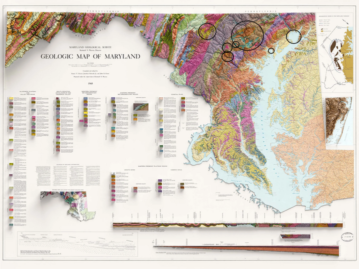
The Waffle Rock could be a product of some large impact crater. The circle does not even pretend to encompass the true size of this crater. I only put it there to show the circular nature of the Maryland and West Virginia geology. You can see it best on the USGS Magnetic Anomaly Map. But please note the extreme geological upheaval with the Precambrian basement turned over. May 12, 2024.

The USGS Magnetic Anomaly Map does not even render the true size of this impact, but putting the above Maryland geology map and this one you can see it is a thousand mile diameter crater about five times the size of Chicxulub. May 12, 2024.

Nested Impact Sphere. June 30, 2024.
I found this rock today at Gauley Bridge, WV.

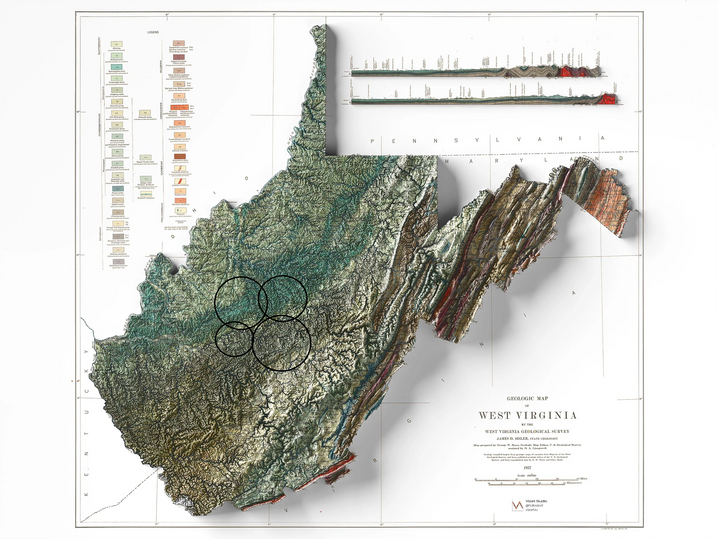
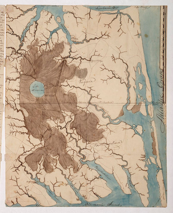
Webster Springs Crater about 40 miles diameter. Crater fingers are shown in the bedrock geology. Aug. 18, 2024.

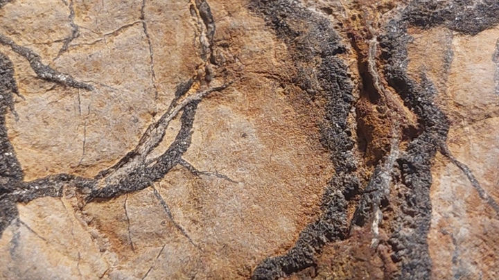
Webster Springs Impact Grid, a shock floor. This is made by crossing shock waves making a cut imprinting. You can also see the iron surface which is from the later iron plasma mist that falls over the impact area. Aug. 18, 2024.
Jim Kingdom picture.

Manganese chert impactite shard. April 5, 2025.
Alex Williams
I’d please found in southern wv

The rock shown above has well-preserved horizontal laminations in argillite a very low-grade metamorphic rock formed by slight alteration of shale). Note that the laminations are rhythmic in their thicknesses and weathering pattern. These are rhythmites. Published research has identified these sediments as proglacial lacustrine turbidites - they appear to be varves. Varves are common sedimentary units in Pleistocene proglacial lake settings. This is a Snowball Earth equivalent. The rhythmicity reflects seasonal changes (summer-winter-summer-winter, etc.). Demonstrable annual layering is scarce in the sedimentary rock record.
𝐒𝐭𝐫𝐚𝐭𝐢𝐠𝐫𝐚𝐩𝐡𝐲: Konnarock Formation, Neoproterozoic, ~750 Ma
𝐋𝐨𝐜𝐚𝐥𝐢𝐭𝐲: Grassy Branch Outcrop - roadcut on the northern side of Rt. 603, just downstream from the Big Laurel Creek-Grassy Branch confluence, west of the town of Troutdale & east of the town of Konnarock, southern Smyth County, southwestern Virginia, USA (36º 40.900’ North latitude, 81º 33.988’ West longitude)
:© James St. John (via Wikimedia Commons)
How would a sediment produce lines vertical/diagonal? Why would sediment be mottled? A very slow process would be unable to produce these effects.

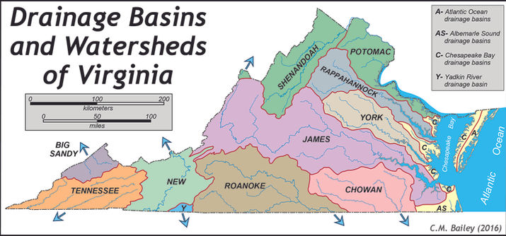
Big Laurel Creek is in Madison County, VA.


You can see some impact craters in the Madison County area on both the gravity and magnetic geology anomaly maps. April 21, 2025.

Chegg Products & Services Geology Anomaly Map. April 21, 2025.

Impact flow strata. The iron came from the meteor/bolide. April 26, 2025.
West Virginia at New River Gorge. Karin Harriss

Fayette County, WV part of the New River Gorge National Park.

Sharing some information to help Identify Fossil Finds... all Collected in West Virginia, USA


Impact splatterform with finger feature fractal. May 1, 2025.
Christopher Miller ·
Some of our finds from yesterday in the creek on our property. hedgesville Wv.

Melt fingers. This is what you get when stretching a plasma. May 1, 2025.
Location where found. May 1, 2025.

See here is a map showing fracking quakes and the two quakes in the specimen area are significant and represent a crustal resolving of stress. May 1, 2025.

Connie Routon Purvis ·
Andalusite from Cambell County, VA.
Note the offset, that is a twinning type phenomenon from being a shock made fast form. May 13, 2025.
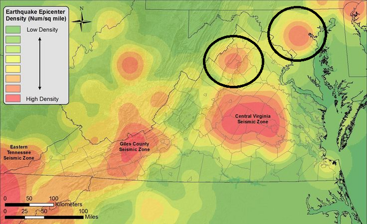
Quake craters are still resolving the impact rubble earth crustal stresses. As you can see the specimen area is between two such crater complexes there are large. The impact relics can be blasted into the specimen area from either of these impacts. That is not to say it is not from a smaller crater that would not show up on this map. May 1, 2025.

The central Virginia quake crater is a type 2 impact from the south which pushes up more damage along its north crater boundary. This map is from Chegg Products and Services it is a type of geology anomaly map. May 15, 2025.

Here is the USGS magnetic anomaly map. It is a different type of map. Is some evidence of this mid state crater. May 15, 2025.
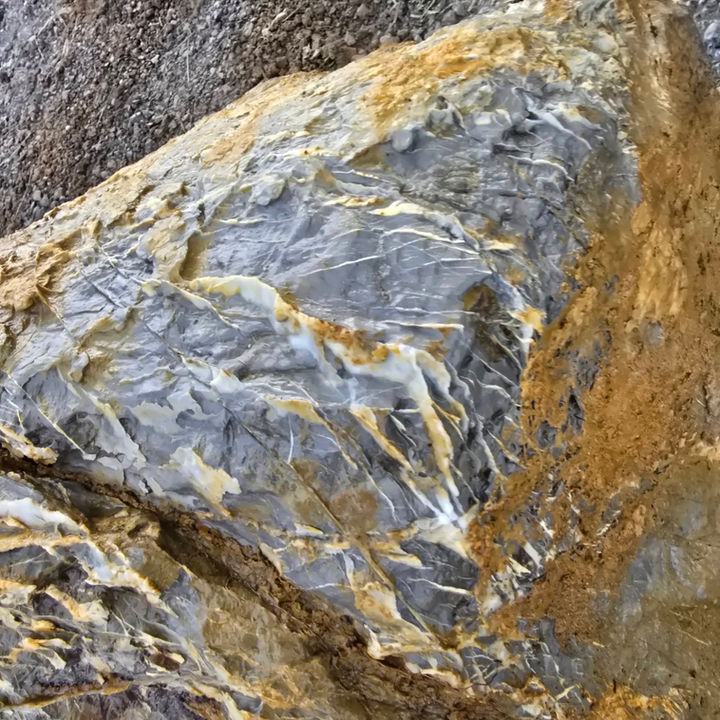
Marble as an impact metamorphic. While raft/plate tectonic theory would have you believe that surface exposures like this were pushed up from far below that is just conjecture and requires more processes than earth impact. May 15, 2025.
So, lets switch to the USGS Sulfur map. As you know meteorites often contain sulfur. As you can see the central impact made a sulfur negative. It is a deep impact. Some impacts are deeper because they were dense or faster. Also impacts get covered by subsequent geologic events. But this map shows another important area of VA. In the NW section you can clearly see a sulfur crater. May 15, 2025.

Article by: Hobart M. King, PhD, RPG
What is Sphalerite?
Sphalerite is a zinc sulfide mineral with a chemical composition of (Zn,Fe)S. It is found in metamorphic, igneous, and sedimentary rocks in many parts of the world. Sphalerite is the most commonly encountered zinc mineral and the world's most important ore of zinc.

Rockingham County, VA. May 15, 2025.
Now going back to the central VA quake maker we can see the evidence of it as a basin depression. You have to admit there is an across VA major central flow anomaly. May 15, 2025.

More specific quake circles are identified by this map. Like the New Madrid faults this shows multiple impacts overlapping. May 15, 2025.


Impact sphere/nodule inversion. Impact made this concave cavity in this molten clast when it hit. It is similar to a ballistic crater. May 18, 2025.
Susan Rhyne
Found this rock in South Fork of the Holston River near Friendship. Yard stick tells size and it is 6” deep. It’s a big rock but seems really, really heavy for its size. Slightly concave on bottom too. I can’t wait to get some idea!
Update: someone told me it is an igneous rock, maybe where an air bubble was as lava cooled. Probably from White Top area. How does that sound to you guys?

Found in Washington County, VA.

And there are a couple of craters in Washington County, VA. May 18, 2025.
Cusp energies. Here we have both thin plane insertion and fractal branching. Thin plane insertion is just the trunk with no branching a higher energy form. May 18, 2025.
Rebecca Zullig
Found on our property in Augusta county.

Impactite proto geode. It is a type of impact nodule. It was about 5,000 degrees F. The great heat causes the expansion and depending on cooling rate crystal formation in the expansion cavities. May 21, 2025.
Tom Bell
No idea what this is, some interesting crystals though

What caused the concave shape of the NE USA coast? It is an offshore large crater. While all craters make subduction pushes depending on the angle the subduction push can be to one side as seen on the above USGS Magnetic Anomaly Map. It has a flare off along its south side due to this angled impact from the east a process similar to bending metal, the metal being the earth's crust in this case. May 21, 2025.
Maryland has active earthquakes. This is due to the smaller impact into the overturned crater wall strata of the above large offshore US coastal impact orogeny. May 21, 2025.
Lake Drummond Crater. Some craters remain without their walls breaking down so water can run through. Lake Drummond is a recent crater causing a natural lake. June 12, 2025.

Impact made impalements. Notice how the hole areas are also deformed inward. Both the impact sphere and the host matrix were plastic at the time. That limestone is shock white typical of crater limestone a shock dolomite. The spheres could have been iron plasma or iron that has dissolved or just fell out leaving hole impressions. That rock will be heavy BTW. 10 July 2025.
Virginia Rockhounding
What caused all of the holes. On New River in Giles County

Inland shells and their inference about time and events. This was found way too far inland. 10 August 2025.
Virginia Rockhounding
What sort if shell would this be? Found in a small river in Highland County.


Impact nodule, was once bedrock, now shock dolomite with nano iron particles from the impacting meteor/bolide. The "lizard feet" are a fractal laminate mosaic from cooling deformation and a record of the energy flow during formation. There is a central iron seam also a contribution from the meteor/bolide. 14 August 2025.
Virginia Rockhounding
Found in Snowville Va, my last post showed this stone and I dont know I didn’t see it but looks like a lizard or something of the sorts pressed into this rock.


Snowville, VA is part of the Giles County Seismic Zone Crater. 14 August 2025.

Uranium Craters of Virginia. The size of these craters would indicate Devonian. While two craters are proximate to the Giles County Seismic Zone Crater they are small by comparison to the overall effect and not proximate to the center. 14 August 2025.
Impactite, charged effect in iron. Raised iron fractals and splatter are not sediment filling veins. Nor is iron precipitated this way. Iron comes out of solution in tiny micro sized particles like you see on sink stains. The close-up picture shows "Constellationing." Constellationing is the organizing of the "common particles." The common particles are a grain/particle size made by the impact pulverizing. Map of the Marshall County WV Crater attached. 22 August 2025.
Cody D. Wade
I have a pretty good idear of what this lil' beauty is, but would like to see what others think. Found in a crick bed (creek ) in northern panhandle of West Virginia! So... whatcha think?


Impactite, shock melt limestone nodule. Smyth County, VA is located in the 4-uranium crater zone of this area. The center circle on the attached map is two craters. 26 August 2025.
Don Treat
posted yesterday: more info,
only rock of this nature/mineral found in large area, looks like was in some form of plastic state at one time.
found in dry creek (name) Smyth county va.
has density close to granite but not quite as hard. Have scraped both colors with dental tool about equal in scratch resistant's.


Impact cinder. Iron fiber crystal fractal (see attached) A fiber crystal of this nature is not volcanic. I have found a half mile of this stuff in the Howell, TN Impact Structure. 27 August 2025.
Virginia Rockhounding
Mandy Lemacks Howard ·August 25 at 12:53 PM ·
Thoughts on this piece? Found in Rockbridge County.

The Rockbridge County, VA craters. Making a radioactive negative means these impacts hit a field of painted radioactive sediments from a previous large spread also made by impact. Since they were not radioactive they make an outline of the impact including the central uplift. 27 August 2025.

Rockbridge County, VA. 27 August 2025.


Impact iron, boxwork encasement. The top specimen is in a flow expansion state with directionality. It has a flow type sheet wave surface on the back. The bottom specimen is boxwork but different than the famous WV waffle stone. This type of impact geometric is a constrained expansion of two circular cells however the overall origin could well be the overlay grid of crossing shock waves of iron splatter just like the waffle stone. Impact melt and wave organization is different with distance from the impact center. Like your specimen the craters of central WV are overlayed making partial geometrics in the older top two. See attached. 24 Sept. 2025.
Lenny Lewis
I found in the Elk river in Clay County, west Virginia. Looks like a fossil of some kind. Let me know what you think. I’m very new at this, but I’m interested in finding different types of rocks and artifacts.

Clay county, WV